PROVINCE
The towns of
Brindisi's Province
The province of Brindisi
has been established in 1927. It covers an area from
Apulian northern hills (Murge) to southern plains, formerly
swampy.
It's a typical earth of frontier, a zone that has always
carried out the task of interconnecting northern latin
Apulia to the southern greek origin land, called Salento.
Almost every town of the province has its own dialect,
different from each other for both words and cadence,
because of the many different migration paths and dominations.
A lot of small harbours and small gulfs can be found
along its shore, as well as long sand beaches alternated
by cliffs; there are many tourist installations on its
northern side.
It's an area with a good agricultural vocation, where
its world famous olive trees and vineyards represent
the most important production, together with other high
quality vegetables.
Click the name of towns on the map
(sections available only in Italian):
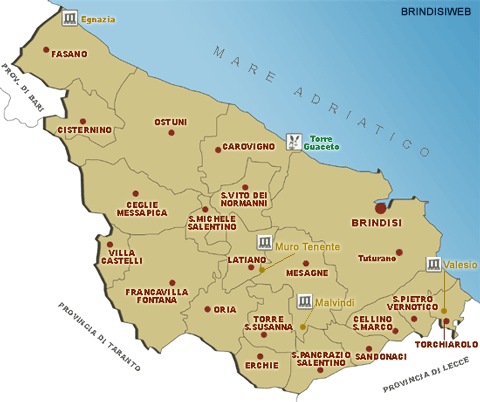
[Fasano]
[Cisternino] [Ostuni]
[Villa Castelli]
[Ceglie M.ca] [San
Vito] [San Michele]
[Carovigno]
[Francavilla] [Latiano]
[Oria] [Mesagne]
[San Pietro V.co]
[Cellino]
[Torchiarolo] [Sandonaci]
[San Pancrazio] [Torre
Santa Susanna] [Erchie]
and moreover:
the archeological site of Egnazia
and Valesio
Marine Protected Area and Natural Reserve of Torre
Guaceto (in english)
the neighbourhood of Tuturano
(Brindisi)
«
Back
|